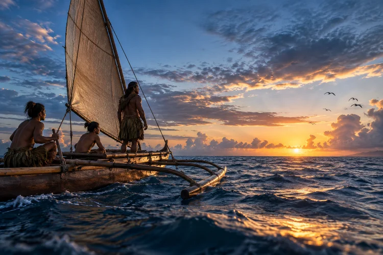
Imagine sailing into the open Pacific without GPS, a magnetic compass, printed charts, or even an island visible on the horizon. Around you is thousands of kilometers of ocean.
Yet an experienced navigator can look at the stars, feel the movement of waves, watch birds, study clouds, and understand where the canoe is heading.
This is the remarkable world of traditional navigation across Pacific Island cultures.
For generations, Pacific communities developed sophisticated systems of wayfinding that allowed sailors to travel between islands separated by enormous distances.
Navigation depended not on a single trick but on combining astronomical observation, ocean swells, winds, wildlife, weather, memory, and detailed knowledge of particular sea routes.
UNESCO notes that Pacific peoples navigated without modern instruments by reading the seas, skies, and marine life around them.
These practices also differed from region to region. Polynesian wayfinding, Marshallese wave piloting, and Carolinian navigation developed within distinct environments and cultural traditions.
The Pacific Ocean was not an empty barrier between islands. For skilled navigators, it was a landscape filled with recognizable signs.
The Ocean Functioned More Like a Road Than a Barrier
From a land-based perspective, the Pacific can seem impossibly large.
For Pacific Island communities, however, ocean routes connected families, trading partners, fishing grounds, ceremonial centers, and neighboring islands. Canoes allowed people to move through this environment much as roads connect communities on land.
UNESCO emphasizes that Pacific civilizations developed exceptional long-distance seafaring skills that supported settlement, trade, social relationships, and cultural exchange across thousands of islands.
Navigation therefore became essential knowledge.
A navigator needed to know far more than a direction such as east or west. They had to understand how winds changed, which stars appeared at different times, how ocean swells interacted, and what signs suggested land might be nearby.
These skills were built through generations of observation.
The result was not random exploration. It was a sophisticated maritime knowledge system adapted to one of the largest ocean environments on Earth.
Stars Created a Mental Compass Across the Pacific
The night sky was one of the most important navigational tools.
Stars rise and set in relatively predictable positions along the horizon. By remembering those positions, experienced sailors could maintain a direction during long nighttime voyages.
Traditional navigators did not simply memorize one constellation.
They learned sequences of stars that could guide the canoe as different celestial objects rose and disappeared during the night.
UNESCO documentation from Micronesia describes Satawal navigators learning star paths connecting islands, with navigational knowlege traditionally preserved through teaching and chants.
Modern Hawaiian wayfinding traditions use a conceptual star compass that organizes sections of the horizon according to the rising and setting positions of stars.
Smithsonian documentation of Hōkūleʻa explains that navigators combine these stellar positions with the Sun, Moon, waves, and bird movements rather than treating the stars as an isolated system.
The compass exists primarily in the navigator’s mind.
Ocean Swells Can Reveal Direction Even Without Stars
Clouds can hide the stars, but the ocean itself continues to move.
Experienced navigators learn to identify persistent swell patterns created by distant winds and weather systems. Even when local conditions change, larger swells can provide directional information.
This requires an extraordinary sensitivity to movement.
A navigator can feel how a canoe rises and falls as waves approach from different directions. Over time, those patterns become recognizable.
Marshallese navigation developed especially sophisticated systems for interpreting waves.
Smithsonian research explains that traditional Marshallese navigators, known as ri-meto, could use wave refraction, reflection, and other disturbances created by islands and atolls to help determine the location of land.
An island can influence incoming swells even before it becomes visible.
For someone trained to read those changes, the sea itself begins to provide information about what lies beyond the horizon.
Birds, Clouds, and Marine Life Can Signal Nearby Land
Navigators also watch living creatures.
Certain seabirds feed far offshore during the day but return to land during particular periods. Watching their direction of flight can therefore provide clues about where an island lies.
Bird behavior becomes especially useful when a canoe approaches its destination.
Clouds can reveal land as well.
Islands influence airflow and moisture, sometimes producing distinctive cloud formations above them. Light reflected from lagoons or shallow reefs may also change the appearance of clouds.
Fish, whales, currents, floating vegetation, and even the smell of the air can contribute additional clues.
UNESCO summarizes Pacific wayfinding as a system using stars, winds, waves, birds, fish, whales, and atmospheric phenomena together rather than relying on one indicator.
This is why traditional navigaton requires constant attention.
A good wayfinder is continuously comparing multiple signals and deciding how much confidence to place in each one.
Marshallese Stick Charts Represented a Different Way of Mapping
One of the most visually striking Pacific navigation traditions comes from the Marshall Islands.
Marshallese navigators created objects now commonly called stick charts.
They were constructed from materials such as palm or coconut strips, fiber, and sometimes cowrie shells. Instead of functioning exactly like modern maps, they represented relationships between islands, ocean swells, and wave interactions.
Smithsonian research distinguishes different types, including mattang, which helped teach general principles of wave behavior, and meddo, which represented relationships among specific islands or routes.
Crucially, navigators generally did not carry these fragile charts like modern sailors carrying nautical maps.
They studied them beforehand.
The important information was memorized and later interpreted through direct experience of the sea.
A Smithsonian collection example describes shells representing islands while sticks indicate wave patterns and navigational relationships.
The chart was therefore partly a teaching device – a physical model supporting knowledge ultimately stored in the navigator’s memory.
Canoe Design Was Part of the Navigation System
Wayfinding would have achieved little without vessels capable of long ocean voyages.
Pacific communities developed many different canoe designs adapted to local waters, resources, routes, and weather conditions.
Outriggers improved stability, while double-hulled voyaging canoes could provide substantial capacity for people, water, food, plants, and other supplies.
Micronesian canoe construction demonstrates how technical and cultural knowledge worked together.
UNESCO’s documentation of Carolinian wayfinding describes canoe building as a community activity involving local materials and an Indigenous mathematical measurement system.
The asymmetrical vessels used in parts of Micronesia were designed for speed and maneuverability, including travel through shallow waters.
Building the vessel was therefore not separate from navigation.
A navigator needed to understand how the canoe reacted to waves and wind. Sail design, hull shape, load distribution, and steering all influenced how environmental signals were interpreted.
The canoe and navigator functioned as one system.
Navigation Knowledge Was Preserved Through Apprenticeship
You cannot learn traditional Pacific navigation simply by memorizing a few stars from a diagram.
Much of the knowledge has historically been transmitted through long apprenticeships.
Young navigators learn from experienced masters by traveling with them, listening to chants and stories, observing environmental signs, and eventually making decisions themselves.
In the Caroline Islands, UNESCO notes that navigation and canoe-making knowledge continues to be passed through apprenticeships led by master navigators and canoe carvers.
However, only a limited number of specialists remain, which led UNESCO to place Carolinian wayfinding and canoe making on its List of Intangible Cultural Heritage in Need of Urgent Safeguarding in 2021.
The learning process is intensely practical.
A student needs to experience darkness at sea, changing waves, wind shifts, and uncertainty.
This explains why oral teaching is so important.
A chant, story, or remembered sequence can organize information, but actual mastery develops through repeated voyages.
Mau Piailug and Hōkūleʻa Helped Revive Polynesian Wayfinding
Colonization and changing transportation systems severely disrupted traditional voyaging knowledge in many Pacific communities.
In Hawaiʻi, a major cultural revival developed around the voyaging canoe Hōkūleʻa and the Polynesian Voyaging Society.
A crucial figure in that revival was Mau Piailug, a master navigator from Satawal in Micronesia.
Smithsonian documentation describes how Piailug trained Hawaiian navigator Nainoa Thompson in reading stars, waves, and other natural signs. Thompson spent extensive time learning to recognize ocean movement and celestial patterns through direct experience.
The importance of this relationship extended far beyond sailing.
Knowledge from Micronesia helped reconnect Hawaiian communities with voyaging practices that colonization had greatly weakened.
Similar revitalization efforts continue elsewhere.
On Taumako in the Solomon Islands, elders established the Holau Vaka Taumako Project to transmit ancestral canoe building and navigation skills to younger generations after decades of cultural disruption.
Wayfinding became a tool for cultural renewal.
Pacific Navigation Was Never One Single Tradition
It is tempting to speak of “Pacific navigation” as though every community used exactly the same method.
The reality is much richer.
Marshallese sailors developed especially detailed knowledge of wave patterns around low-lying atolls. Satawal navigators preserved complex star-path systems.
Hawaiian wayfinding revival developed its own star-compass framework, while Taumako sailors maintained traditions shaped by their particular islands and routes.
UNESCO’s The Canoe Is the People project specifically highlights both the similarities and differences among Pacific voyaging traditions.
Different environments demanded different priorities.
A navigator approaching a tiny coral atoll faces different challenges from someone traveling between larger volcanic islands.
Local wind patterns, currents, reefs, bird populations, and seasonal conditions all affect what information becomes useful.
Traditional navigation therefore works because it is deeply connected to place.
Wayfinding Remains Part of Cultural Identity Today
Traditional navigation is not simply an interesting technology from the past.
For many Pacific comunities, its revival has become part of language preservation, environmental education, cultural pride, and reconnection with ancestral identity.
UNESCO has promoted navigation knowledge in Pacific classrooms precisely because younger generations can learn science, geography, mathematics, history, and culture through traditional wayfinding.
Modern navigators may understand GPS and electronic instruments while still choosing to practice ancestral methods.
That does not make the tradition less authentic.
Living traditions survive by adapting.
More importantly, wayfinding offers a different way of thinking about the environment. Instead of separating stars, waves, animals, weather, and human movement into unrelated subjects, navigation connects them into one system.
The navigator succeeds by paying attention to relationships.
Traditional navigation across Pacific Island cultures demonstrates an extraordinary ability to read the ocean as a landscape filled with information.
Stars provided direction, ocean swells revealed hidden islands, birds and clouds signaled approaching land, while carefully designed canoes made long-distance voyaging possible.
Marshallese stick charts, Carolinian apprenticeships, and Polynesian star-compass traditions show just how diverse these systems became.
Their importance goes beyond transportation.
Wayfinding carries language, ecological observation, history, identity, and relationships between generations. Modern revival projects such as Hōkūleʻa and Holau Vaka Taumako show that this heritage remains alive.
To understand Pacific navigation deeply, look beyond the idea of “sailing without instruments.” The navigator was the instrument – trained to read an entire enviromental world that others might simply see as empty ocean.